A ZIP code is a five‑digit postal code used in the United States to help the U.S. Postal Service (USPS) sort and deliver mail more efficiently. The term “ZIP” stands for Zone Improvement Plan, reflecting its original purpose: to speed up mail processing and delivery across a growing and highly mobile population. facts.usps
What a ZIP code represents
A standard U.S. ZIP code (for example, 90210) is tied to a specific geographic delivery area, not strictly a city boundary. It can cover a neighborhood, a post office zone, or even part of a large building or campus, and a single city may have multiple ZIP codes for different sections. ZIP codes are designed so that automated sorting machines can quickly route mail to the correct regional hub, then to the right local post office and delivery route. en.wikipedia
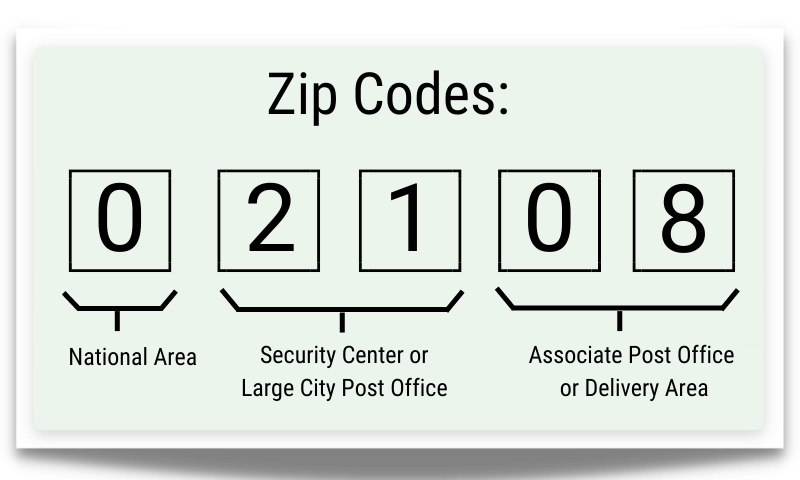
How the digits are structured
The five‑digit ZIP code is structured in layers of geography: britannica
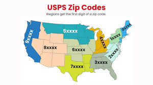
- The first digit represents a broad region of the country (for example, 0–1 for the Northeast, 9 for the West Coast). facts.usps
- The next two digits narrow it down to a sectional center facility or a larger local area. zors
- The last two digits identify a specific post office or delivery zone within that area. britannica
Later, the ZIP+4 format was introduced (for example, 90210‑1234), adding four extra digits that can pinpoint a block, a building, or even a high‑volume business. This extra precision helps USPS and shipping companies sort mail more finely and reduce errors. smarty
Why ZIP codes matter beyond mail
ZIP codes are now used far beyond just postage. They help define “service areas” for banks, insurance firms, and retailers, and they are widely used in analytics to estimate income levels, demographics, and health‑related trends in different neighborhoods. Because people in neighboring ZIP codes can differ greatly in income, education, and access to services, ZIP codes have become a shorthand way to describe socioeconomic and geographic communities in the United States. edq
In short, a ZIP code is both a practical tool for fast, accurate mail delivery and a powerful geographic label that organizations use to understand and segment the population. smarty
This is a really helpful guide! I always get confused with different ZIP codes when shipping packages. Thanks for explaining this so clearly.
Thanks Alice! Glad you found it useful. Feel free to check out our other guides as well.
Great write-up! Quick question: does this apply to PO Boxes as well, or is the layout different?